
Walking Trails, Hikes, Gyms & More
Explore the many ways to stay fit in our county
Care for a hike?
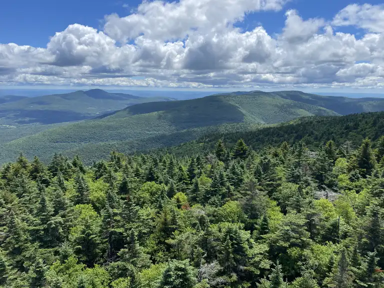
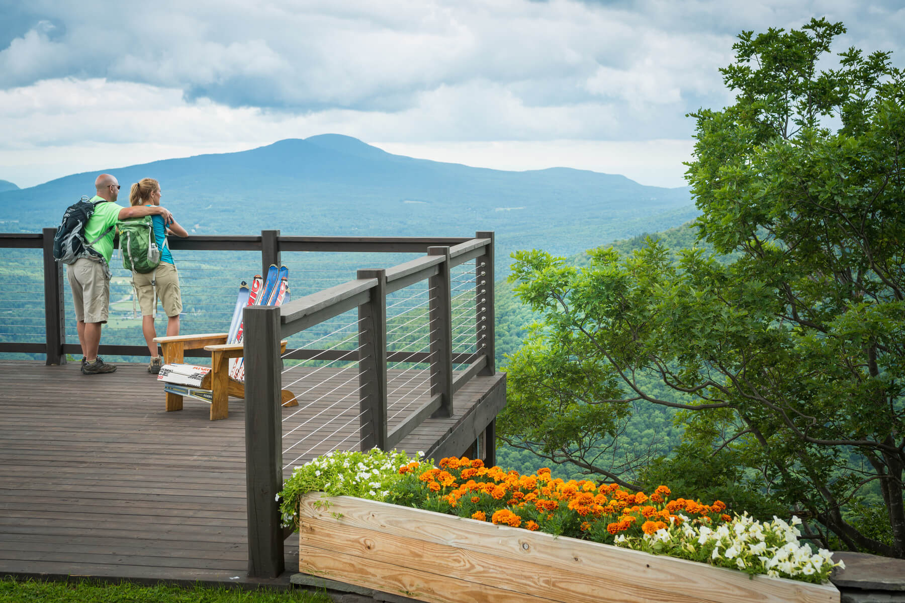
Greene County, New York is a hiker’s playground tucked into the heart of the Catskill Mountains. From gentle forest walks and rail trails to rugged climbs with sweeping mountain views, the area offers something for every pace and experience level. Iconic spots like Kaaterskill Falls and North–South Lake showcase dramatic waterfalls, cliffs, and classic Catskills scenery, while challenging routes such as the Devil’s Path and Hunter Mountain reward adventurous hikers with unforgettable summit views. With quiet nature preserves, scenic overlooks, and miles of protected wilderness, hiking in Greene County blends wild beauty, fresh mountain air, and a deep sense of escape just a few hours from the city.

Over 20+ Hikes and Walking Trails
Old Mill Falls View
Difficulty: Easy
Distance: 200 feet round trip
Waterfall height: 16 feet
Best time to visit: After heavy rain
Crowds: Typically uncrowded
Located in the Platte Clove region—also known as Devil’s Kitchen—Old Mill Falls sits along Plattekill Creek, which feeds several well-known Catskills waterfalls. This easy, short walk begins on Josh Road at the top of Platte Clove Road in Hunter. Park near the small red house and walk about 100 feet south of the King Post Bridge to reach the falls.
Named after a mill that once operated downstream in the 1800s, Old Mill Falls may be modest in height, but its wide span makes it especially scenic. When water levels are high, delicate curtains of water spill across the entire creek bed, creating a beautiful display. For the most impressive views, visit in spring or shortly after a heavy rainfall.
Plattekill Falls Hike
Difficulty: Easy
Distance: 0.5 miles round trip
Waterfall height: 70 feet
Highlights: Stunning views and excellent photography
Crowds: Usually uncrowded
Pouring through a narrow opening at the top of a dramatic cliff, Plattekill Falls feels like something straight out of a postcard. To reach the falls, park on Josh Road near the small red house and follow the trail for about a quarter mile alongside Plattekill Creek. The path winds downstream past Old Mill Falls and through lush, forested terrain before revealing this spectacular cascade.
The waterfall plunges 70 feet before rejoining the creek below, surrounded by moss-covered rock walls and vibrant greenery that give the area a magical, secluded feel. The rocky streambed invites exploration and gentle rock hopping, making this an ideal spot for families to linger and enjoy the beauty of the Catskills. It’s an easy hike with a big reward—perfect for a peaceful day outdoors.
Diamond Notch Falls Trail
Difficulty: Easy to Moderate
Route options: 2-mile round trip or 4-mile loop
Waterfall height: 15 feet
Dog-friendly: Yes
Crowds: Typically uncrowded
Also known as West Kill Falls, Diamond Notch Falls offers hikers a scenic Catskills experience with flexible route options. For a longer adventure, take the four-mile loop beginning at Diamond Notch Road in Lanesville, following well-maintained trails through lush forest to the falls. The waterfall cascades about 15 feet and can be admired from a bridge at the top or from the shallow pool below.
Those looking for a shorter, more direct hike can reach the falls via a 0.7-mile trail from the Spruceton Road parking area. Whether you choose the longer loop or the quicker out-and-back, Diamond Notch Falls delivers a peaceful, rewarding hike with beautiful wilderness scenery.
Ashley Falls Trail at North–South Lake Campground
Difficulty: Easy
Distance: 0.6 miles round trip
Waterfall height: 61 feet (three tiers)
Camping: Very close by
Crowds: Likely to be busy
Explore Ashley Falls
If you’re looking for a waterfall hike with nearby camping, North–South Lake Campground is a perfect choice. Set up your tent, then take the short Mary Glen Trail off the main campground road to reach Ashley Falls.
This striking waterfall drops 61 feet in three tiers over jagged, angular rock formations, giving it a dramatic, unique look. The falls can slow to a trickle during the height of summer, so spring and fall are the best times to visit. If you’re not camping overnight, you can still enjoy the hike with a day pass at the campground entrance.
Fawns Leap Trail
- Difficulty: Moderate (steep)
- 0.25 miles roundtrip
- 24 foot plunge drop waterfall
- Popular swimming hole
- Likely to be crowded
This waterfall is currently overcrowded. There is little to no parking and cars are being towed for illegal parking. Please consider alternative options.
Safety and Parking Instructions
Joining Bastion Falls and Kaaterskill Falls in the Haines Falls region is the 24-foot Fawns Leap waterfall, a beautiful section of the Kaaterskill Creek that has also been the subject of paintings and photographs for over a century. Just off route 23A, these falls double as a popular swimming hole in warm summer months. A deep pool lies at the base of the milky white cascade, nestled within a rocky ravine carved out by the falls themselves, and it’s just big enough for a refreshing dip.
Glen Falls House Trail
Difficulty: Easy
Highlights: Popular swimming hole
Trail info: Check in at the Glen Falls House
Crowds: Usually uncrowded
Discover Glen Falls
Round Top, NY is a waterfall lover’s dream, with several stunning falls nearby—including Glen Falls and East Kill Falls. Glen Falls is especially impressive, featuring three distinct cascades, two of which offer excellent swimming spots.
Parking is available at the Glen Falls House, and the staff at the front desk can provide directions to the best trail routes. Whether you’re hiking or planning a refreshing swim, Glen Falls is a beautiful, easy-access destination in the Catskills.
East Kill Falls Access
- Difficulty: Hard
- 7.2 miles roundtrip
- Small bushwack required
- Common for wildlife sightings
- Virtually unknown, not likely to have many visitors
If you’re feeling up to a full day on the trail, trek into East Kill Falls. This scenic 7.2 mile round trip trail starts at a parking lot at the end of Stork Nest Road off of Maple Lawn Road. At approximately .3 miles in, you will come across a DEC trail register. Don’t forget to sign in! While the trail doesn’t go all the way to the falls, it does come within 100 – 200 feet and, once you hear the stream, you can easily bushwhack to it. In addition to the falls, this trail is well-known for wildlife sightings.
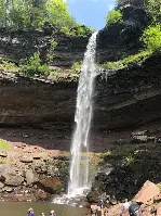
Kaaterskill Falls Viewing Platform Trail
Difficulty: Moderate
Distance: 1.4 miles round trip
Waterfall height: 260 feet (two tiers)
Highlights: Views of Bastion Falls
Crowds: Likely to be busy
Kaaterskill Falls and its viewing platform are open to visitors. Please note that parking is restricted—any vehicles parked illegally along Route 23A may be towed, and the Molly Smith parking area is currently closed. Be sure to park only in designated areas or use alternative options.
Check out these easier walking paths…
Kaaterskill Rail Trail
Huckleberry Trail (Windham Path)
Mountain Top Arboretum trails
Mawignack Preserve
Cohotate Preserve
Cairo Nature Preserve
Ramshorn–Livingston Audubon Sanctuary
Dutchman’s Landing Riverwalk
North–South Lake walking paths
Alligator Rock Trail
Boulder Rock Trail
Platte Clove Preserve nature path
Kaaterskill Falls viewing platform trail
Catskill Village walking loops
Athens Village walking trail
Better to health to every corner of Greene.